


RIEGELSVILLE Voting District, Bucks County, Pennsylvania
About
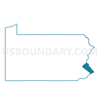
Outline

Summary
| Unique Area Identifier | 657884 |
| Name | RIEGELSVILLE Voting District |
| County | Bucks County |
| State | Pennsylvania |
| Area (square miles) | 1.08 |
| Land Area (square miles) | 1.01 |
| Water Area (square miles) | 0.07 |
| % of Land Area | 93.36 |
| % of Water Area | 6.64 |
| Latitude of the Internal Point | 40.59490740 |
| Longtitude of the Internal Point | -75.19855570 |
Maps


Graphs
Select a template below for downloading or customizing gragh for RIEGELSVILLE Voting District, Bucks County, Pennsylvania


Neighbors
Neighoring Voting District (by Name) Neighboring Voting District on the Map
- DURHAM TWP VTD DURHAM, Bucks County, PA
- Holland township voting district 1, Hunterdon County, NJ
- Pohatcong township voting district 2, Warren County, NJ
- WILLIAMS TWP VTD EASTERN, Northampton County, PA
Top 10 Neighboring County Subdivision (by Population) Neighboring County Subdivision on the Map
- Williams township, Northampton County, PA (5,884)
- Holland township, Hunterdon County, NJ (5,291)
- Pohatcong township, Warren County, NJ (3,339)
- Durham township, Bucks County, PA (1,144)
- Riegelsville borough, Bucks County, PA (868)
Top 10 Neighboring Place (by Population) Neighboring Place on the Map
Top 10 Neighboring Elementary School District (by Population) Neighboring Elementary School District on the Map
Top 10 Neighboring Secondary School District (by Population) Neighboring Secondary School District on the Map
Top 10 Neighboring Unified School District (by Population) Neighboring Unified School District on the Map
- Easton Area School District, PA (63,870)
- Wilson Area School District, PA (15,477)
- Palisades School District, PA (14,936)
Top 10 Neighboring State Legislative District Lower Chamber (by Population) Neighboring State Legislative District Lower Chamber on the Map
- General Assembly District 23, NJ (229,972)
- State House District 136, PA (63,631)
- State House District 143, PA (62,909)
Top 10 Neighboring State Legislative District Upper Chamber (by Population) Neighboring State Legislative District Upper Chamber on the Map
Top 10 Neighboring 111th Congressional District (by Population) Neighboring 111th Congressional District on the Map
- Congressional District 15, PA (721,828)
- Congressional District 7, NJ (672,885)
- Congressional District 8, PA (672,685)
- Congressional District 5, NJ (666,551)
Top 10 Neighboring Census Tract (by Population) Neighboring Census Tract on the Map
- Census Tract 181, Northampton County, PA (6,324)
- Census Tract 105, Hunterdon County, NJ (5,291)
- Census Tract 323, Warren County, NJ (3,339)
- Census Tract 1066, Bucks County, PA (2,012)